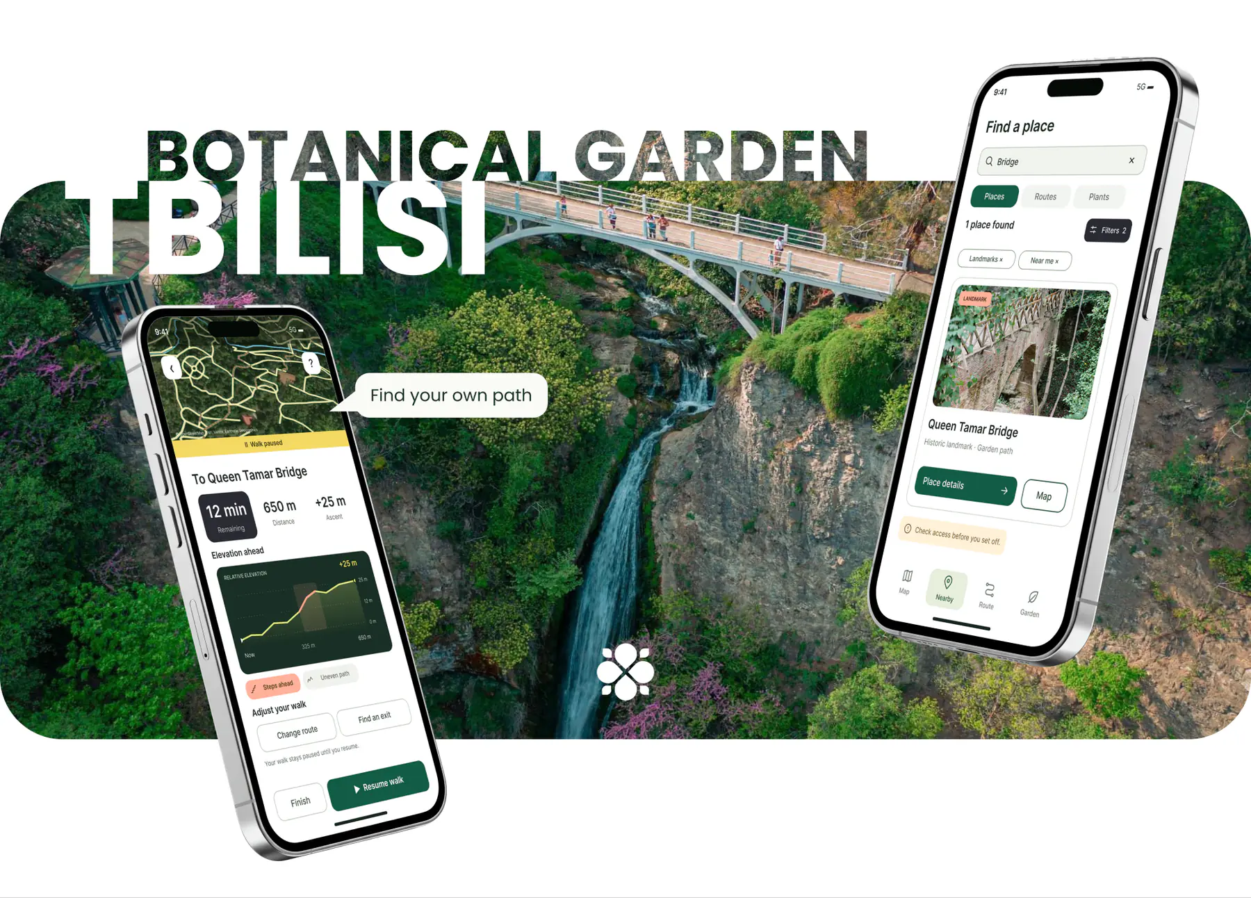

Tbilisi Botanical Garden


 Find your route
A mobile guide
to Tbilisi Botanical Garden
01 Goal
Create a mobile guide to Tbilisi Botanical Garden that helps visitors choose a route and find their way during a walk.
02 Problem solving
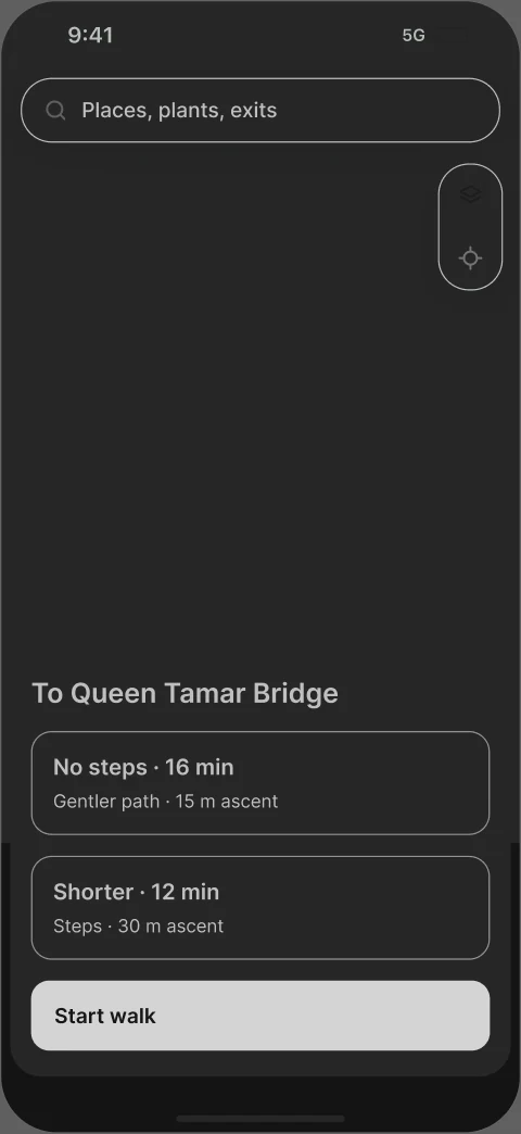
The guide brings the garden map, place information and walk planning together. Visitors can compare time, terrain and steps before choosing a route, then adjust their walk, find a rest stop or head to an exit.
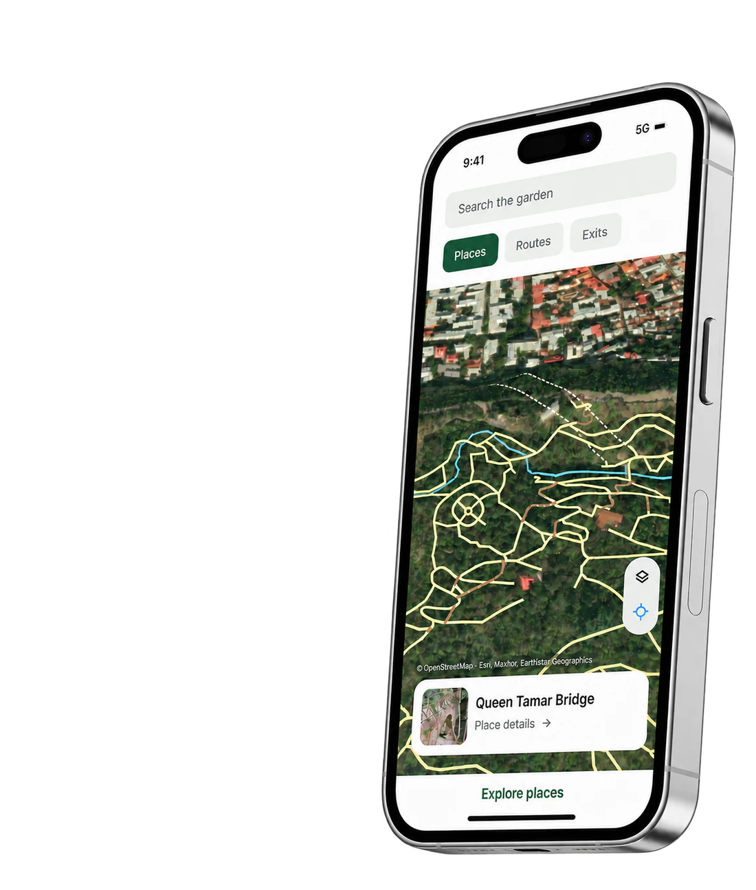
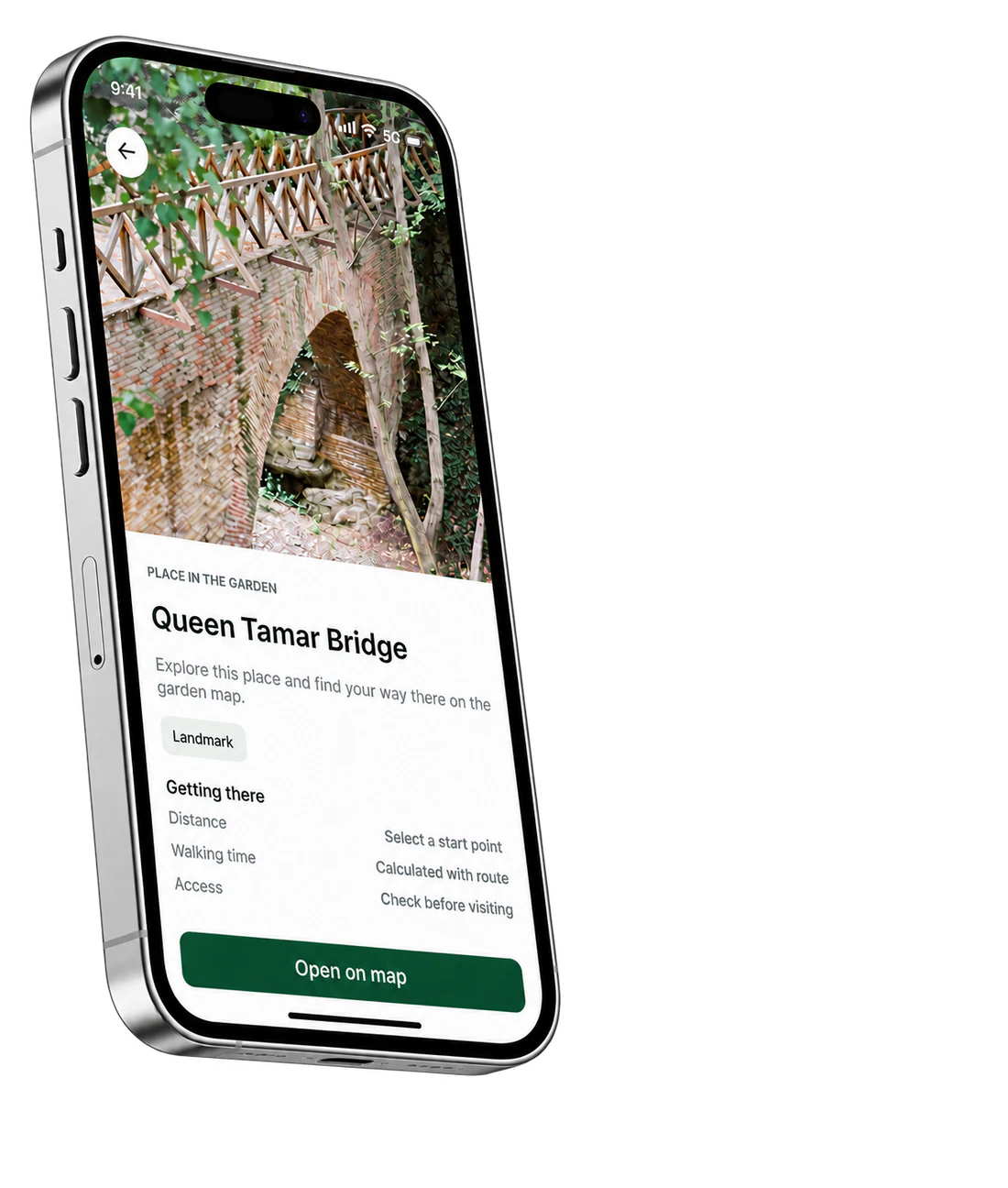
Design Process
Applied the Double Diamond framework to move from research evidence to a testable route and a coherent visual system.

Discover
- Brief and constraints
- Desk research
- 77 visitor reviews
- Competitive analysis
2 weeks
Define
- Visitor jobs
- Scenario hypotheses
- MVP priorities
- Information architecture
1 week
Develop
- User flow
- Wireframes
- Screen states
- Interactive prototype
1 week
Design
- Visual concept
- Map presentation
- UI components
- Screen design
2 weeks
Competitive Analysis
I compared six products through the questions that come up during a visit: Where am I? How demanding is this route? Is the path open? What is nearby? Will the guide still work offline? The answers helped define which patterns belong in the garden guide.
| Visitor question | SmartGuide | Bloomberg | Chicago | NYBG | Kew | NPS |
|---|---|---|---|---|---|---|
| 01 Where am I? | × | × | ✓ | ✓ | × | ✓ |
| 02 How demanding is the route? | × | ✓ | × | × | ✓ | × |
| 03 Is the path open? | × | × | × | × | ✓ | ✓ |
| 04 What is nearby? | ✓ | ✓ | ✓ | ✓ | ✓ | ✓ |
| 05 Can I use it offline? | ✓ | × | × | × | × | ✓ |
| 06 What changes with the season? | × | × | ✓ | ✓ | × | × |
- SmartGuide
- Digital audio guides
- Bloomberg Connects
- Arts and culture guides
- Kew
- Royal Botanic Gardens, Kew
- Chicago
- Chicago Botanic Garden
- NYBG
- New York Botanical Garden
- NPS
- US National Park Service app
In-Depth Interviews & Scenarios
77 public Tripadvisor reviews inform four scenarios for future in-depth interviews: entrance choice, climbs, nearby facilities and changing the route. Counts refer to this review sample, not all visitors. The characters and statements are scenario models.


 4 scenariosto explore with visitors6 topicsfor future interviews
13/77
reviews mention time and planning11/77
mention terrain, climbs or stairs8/77
mention closures or blocked paths9/77
amenities · navigation · seasonality9 mentions for each theme
SSofia
First visit · 2 hours
“Check the entrance before the climb. A wrong start changes the whole walk.”Scenario model
DDaniel
Solo visit · 1.5 hours
“Distance is not enough. Time and elevation change which route I choose.”Scenario model
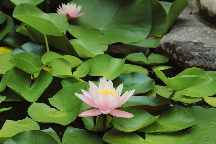
NNino
Local visitor · with a friend
“I need to know what is nearby, how far it is and whether the path is open.”Scenario model
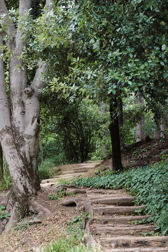
AAlex
With his mother · easy pace
“Show me the next section before the path becomes too steep or tiring.”Scenario model
Find your place.
Choose your path.
Know the effort.
Explore the garden.
Adjust your walk.
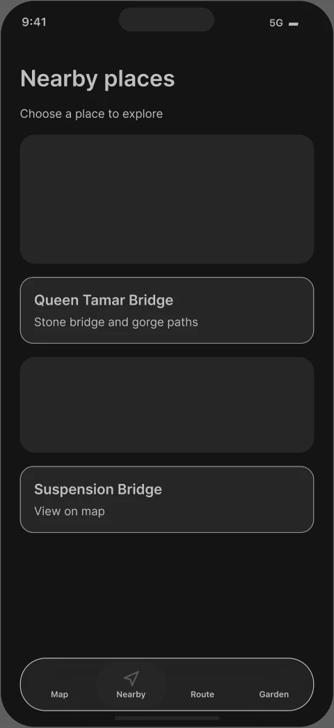
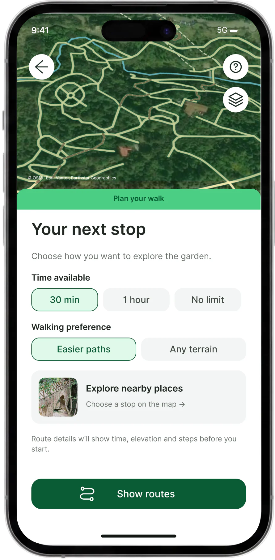 Nearby places
 Choose your routeFind an exitNBGG
Journey Mapping
Four key moments from the full visitor journey, from arrival to the exit.
Based on review themes; positive moments and emotions are hypotheses to test.
| Entering the garden | Choosing a route | Changing the plan | Finding an exit | |
|---|---|---|---|---|
| Actions | Find an entrance. Check access and opening information. | Choose a place. Compare time, terrain and steps. | Pause, change the destination or look for an easier path. | Choose an exit. Follow the path back to the city. |
| Goals | Start the visit without an unnecessary climb. | Choose a walk that fits available time and energy. | Keep exploring without losing orientation. | Leave in time through a suitable exit. |
| Friction | An entrance may be closed; its status may be unknown. | Distance alone does not explain the effort. | Fatigue or a blocked path makes the original plan unsuitable. | The nearest exit and remaining walk may be unclear. |
| Positive moments* | The entrance is found and the visit can begin. | The next section feels manageable. | A clear alternative restores a sense of control. | The walk ends without unnecessary detours. |
| Emotions* |  Anticipation |  Uncertainty |  Concern |  Relief |
Information Architecture
Four sections connect finding a place, choosing a path and planning a visit.
Selected branches are shown below; shared details and recovery states continue in the full architecture.
Map
- Home and map
- My position
- Places on the map
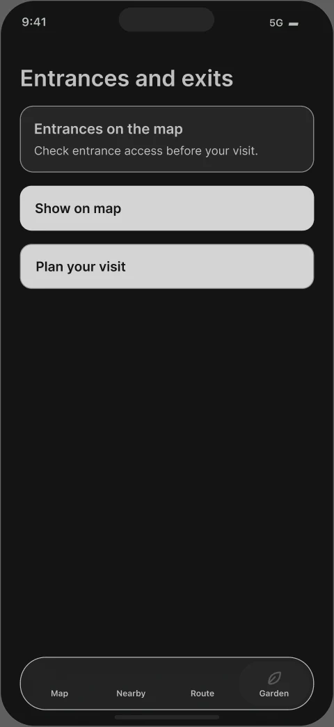
- Entrances and exits
Nearby
- Places nearby
- Categories and facilities
- Filters
- Open now · no stairs
Route
- Route options
- Active walk
- Change plan
- Route to an exit
- Walk complete
Garden
- Opening hours
- Visitor guidance
- Accessibility
- Offline map
- Data sources
User Flow
Choose a place, check the path and start walking.
Manual starting points and alternative paths keep the journey moving when location or access changes.
Main journey excerpt · search, offline and recovery branches continue below
Find a place. Check the path.
Make the garden your own.
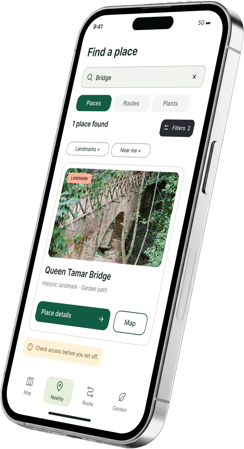
Pause when you need to.
Keep exploring at your pace.
Wireframes
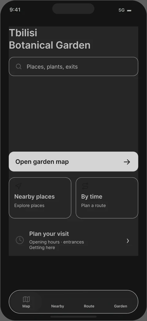
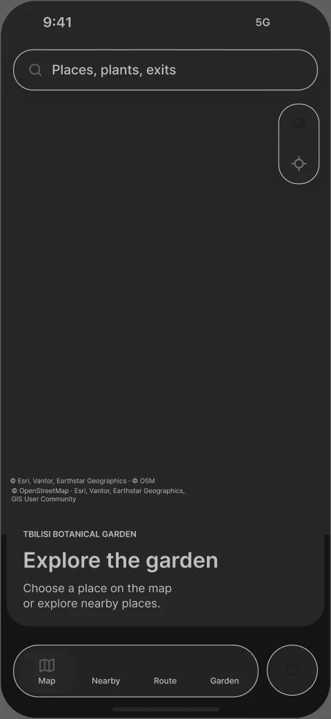
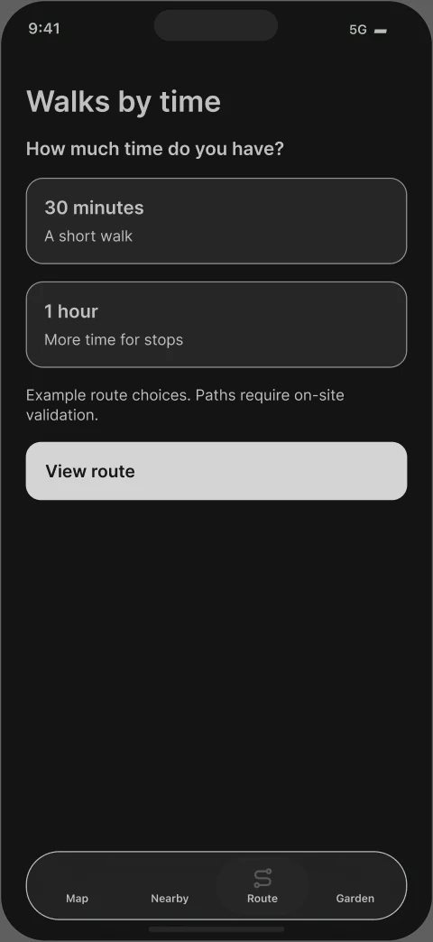
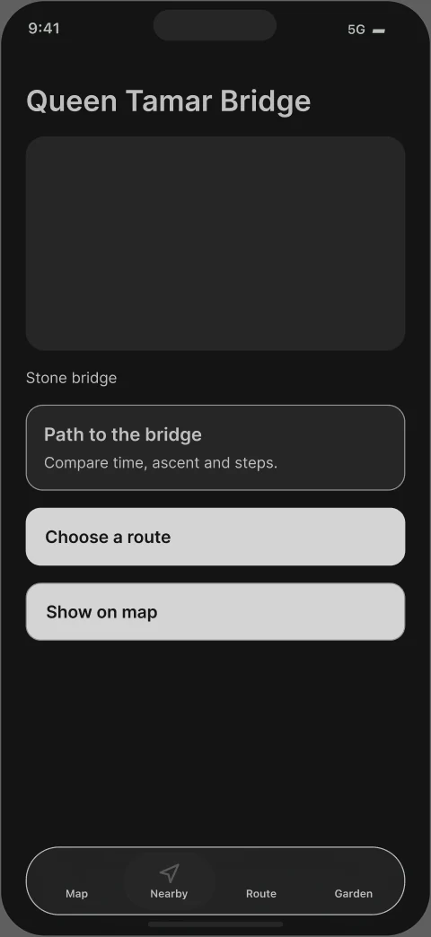
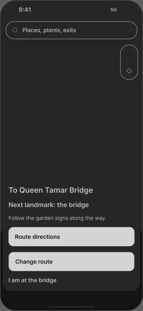
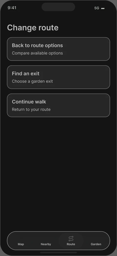
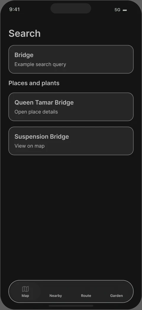
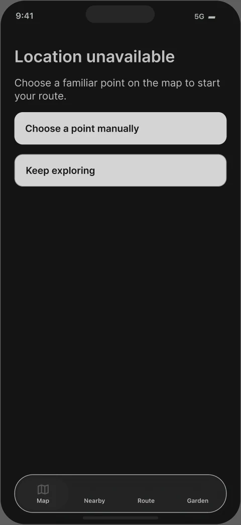
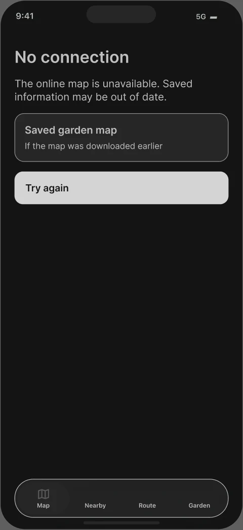
Wireframes define content and actions across search, route selection,
navigation and recovery states.
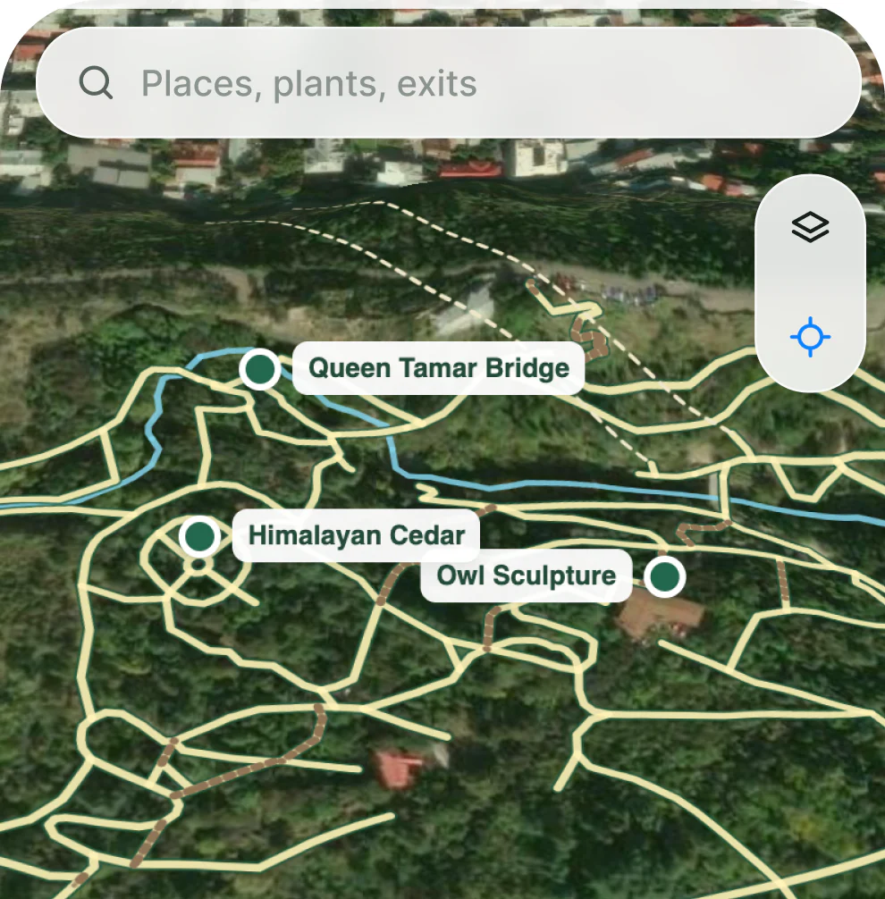
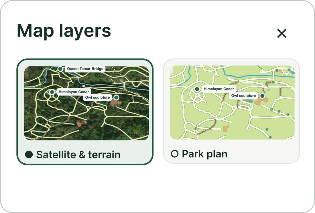
Map layers
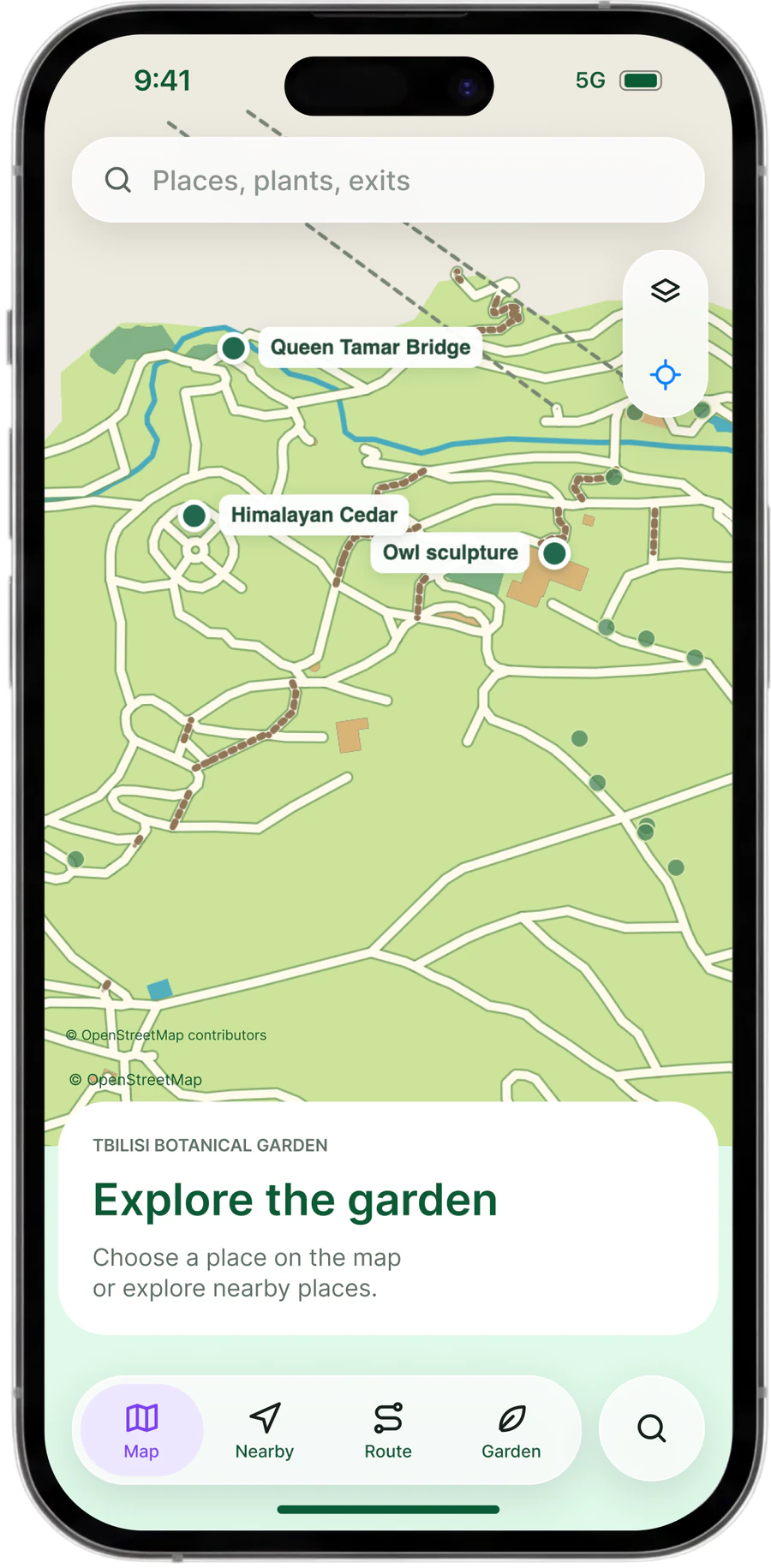
Read the terrain in satellite view. Find paths and landmarks on the park plan.
Switch between them without losing your selected place.
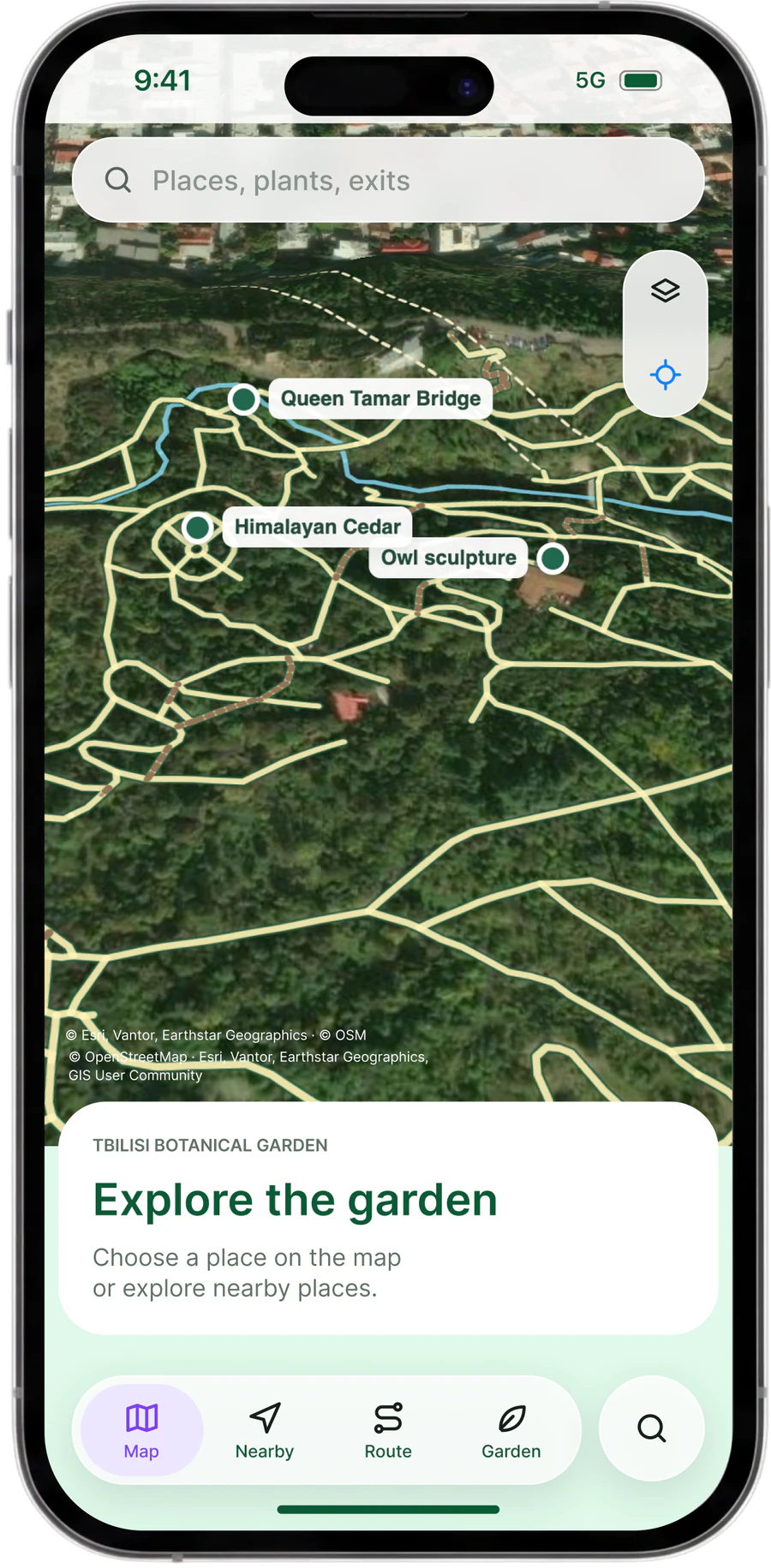
Open layers
One tap.
Two ways to read the map.
Choose your view
Different view. Same place.
Your point of reference stays on the map.
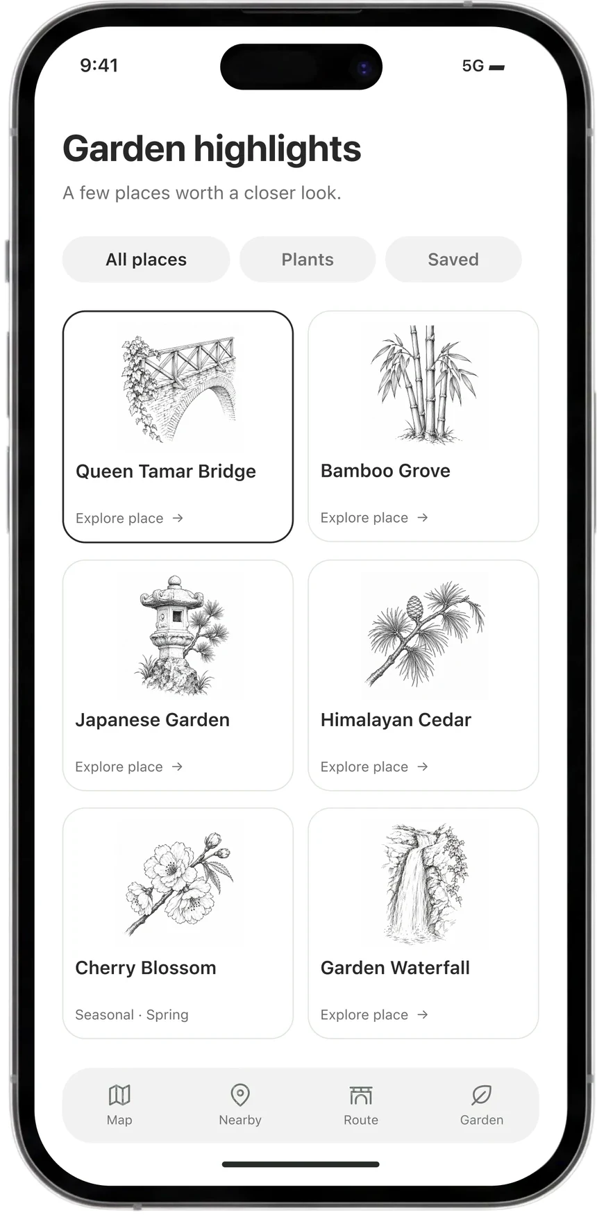
Landmarks
Recognise a place. Discover its details. Find it on the map.
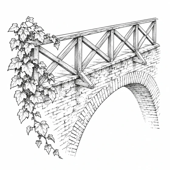 Queen Tamar Bridge
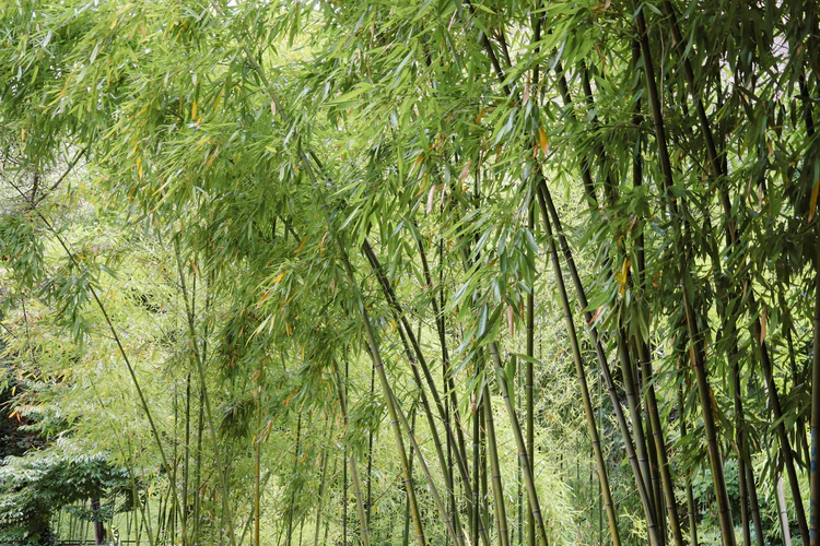
 Bamboo Grove
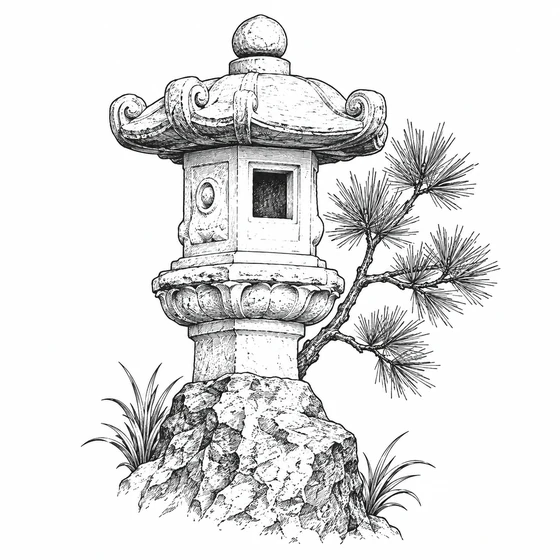 Japanese Garden
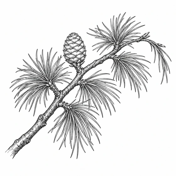 Himalayan Cedar
 Cherry Blossom
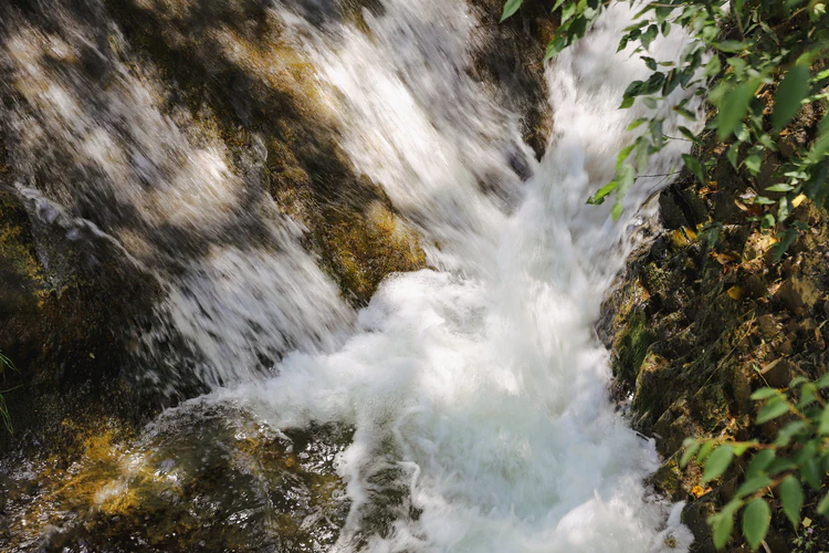
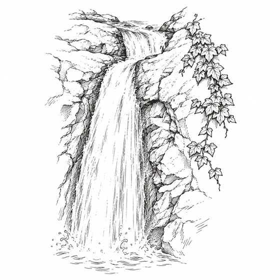 Garden Waterfall
Six landmarks, one visual language.
Getting started
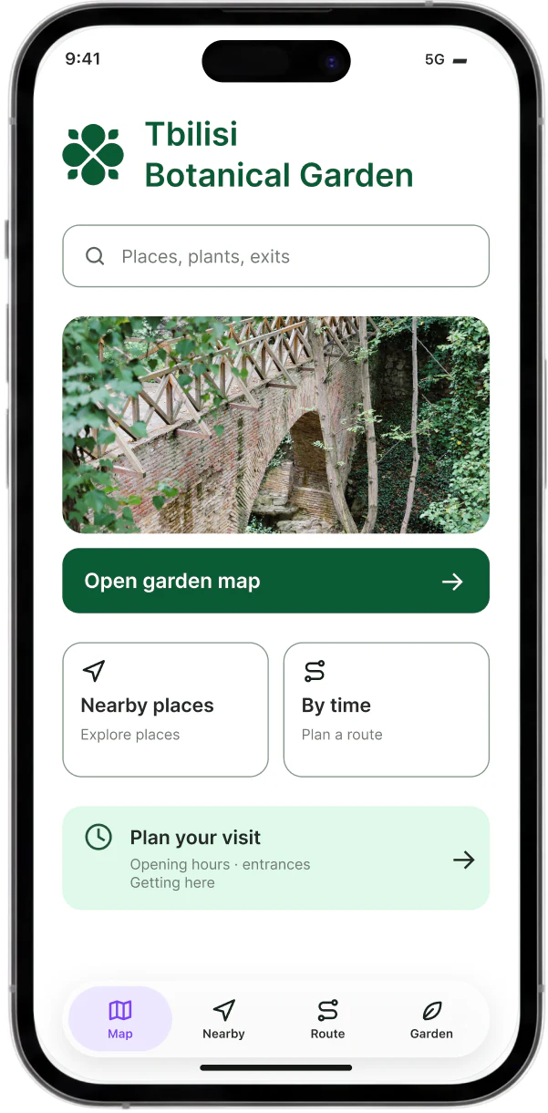
Open the guide, get your bearings and explore the garden.
The first visit starts without an account.
A simple way in
Explore nearby places, plan your visit or open the map straight away.
Location is requested when you choose to find yourself on the map.
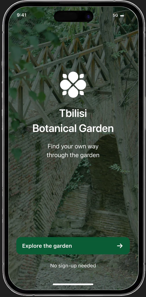 Welcome
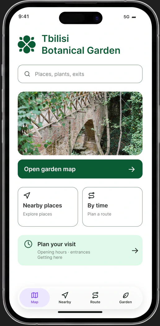 Home
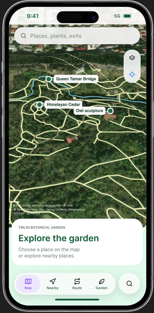 Explore the map
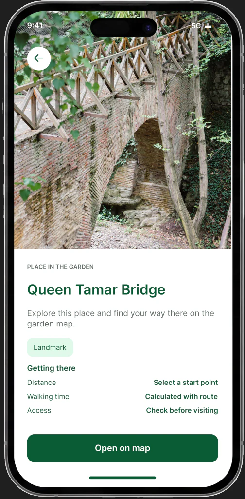 Place details
Explore your way
Four ways to turn a garden visit into a walk that fits you.
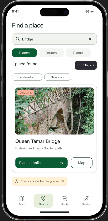
Find a place
Search for a landmark, a plant or an exit. Move from a result to its details without losing your context.
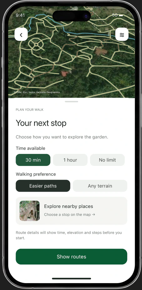
Make time for the garden
Choose how long you have and the kind of path you prefer before you start.
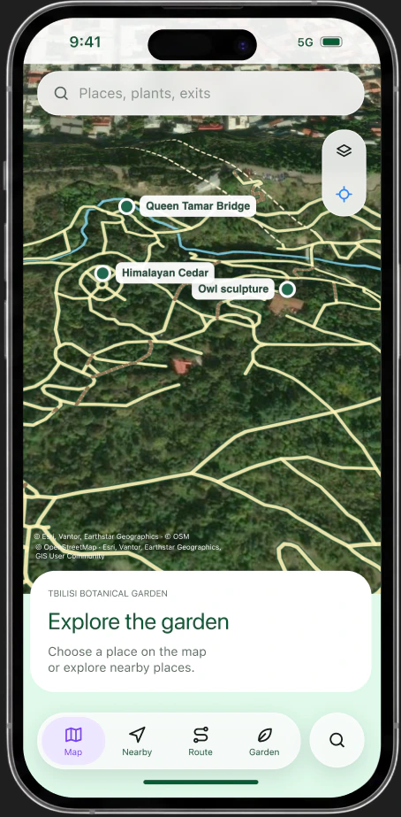
Explore on the map
See places in their surroundings. Switch the map view and keep your bearings.
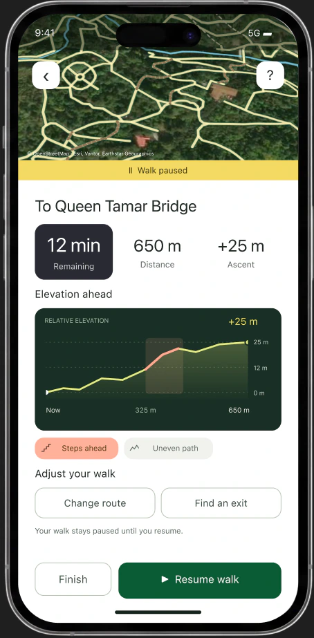
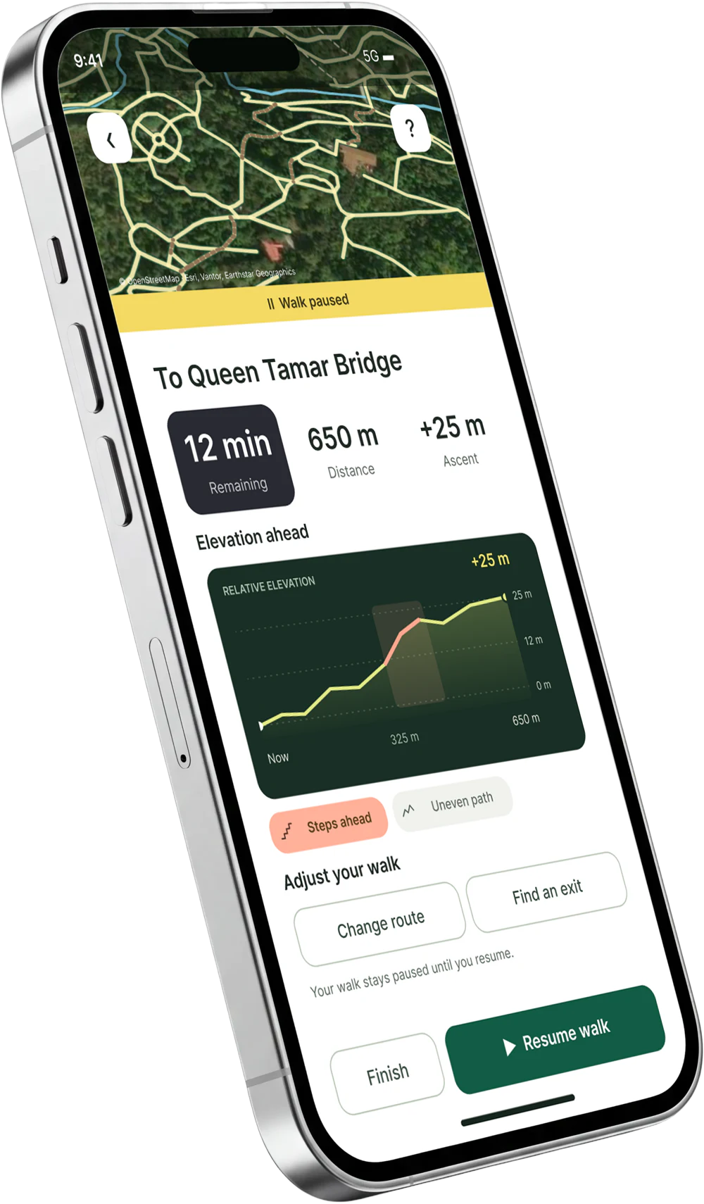
Adjust your walk
Pause to check the terrain ahead. Continue, choose another path or find an exit.
Your starting point
Locate yourself, or choose a familiar place to start.
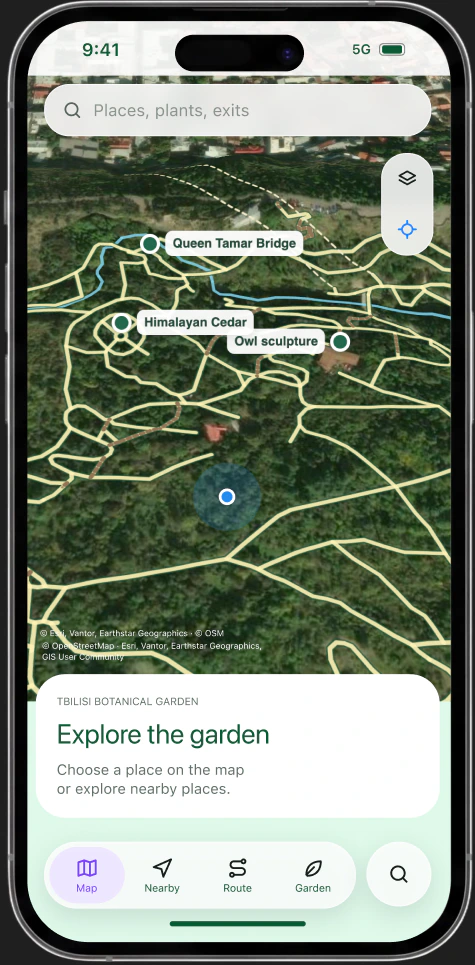
You are here
Tap your location
Allow location access to find yourself. Or choose a start manually.
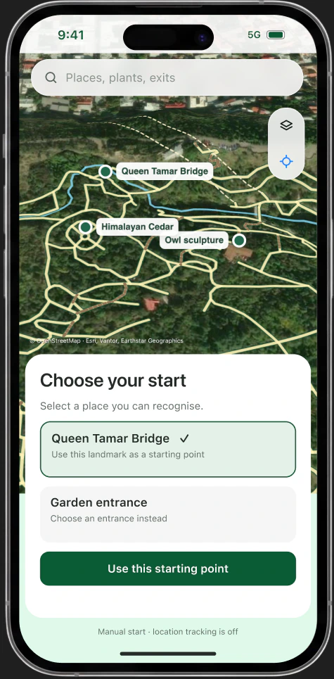
A starting point, without live tracking
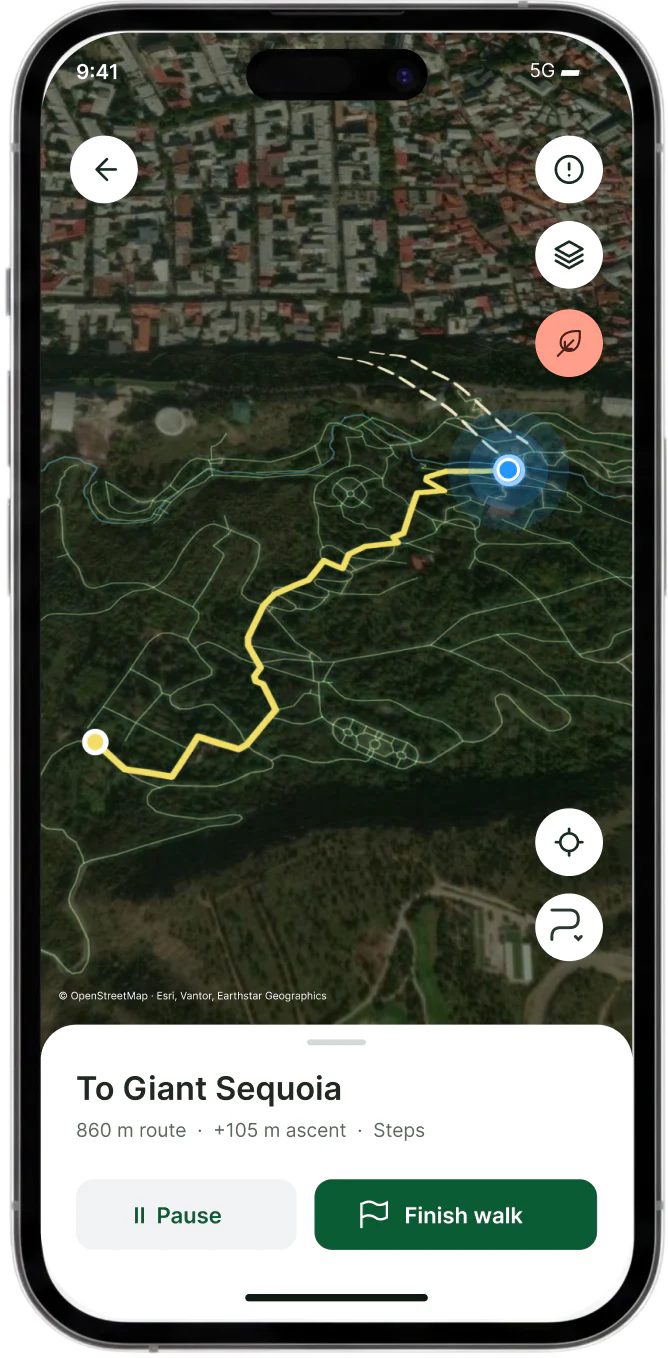
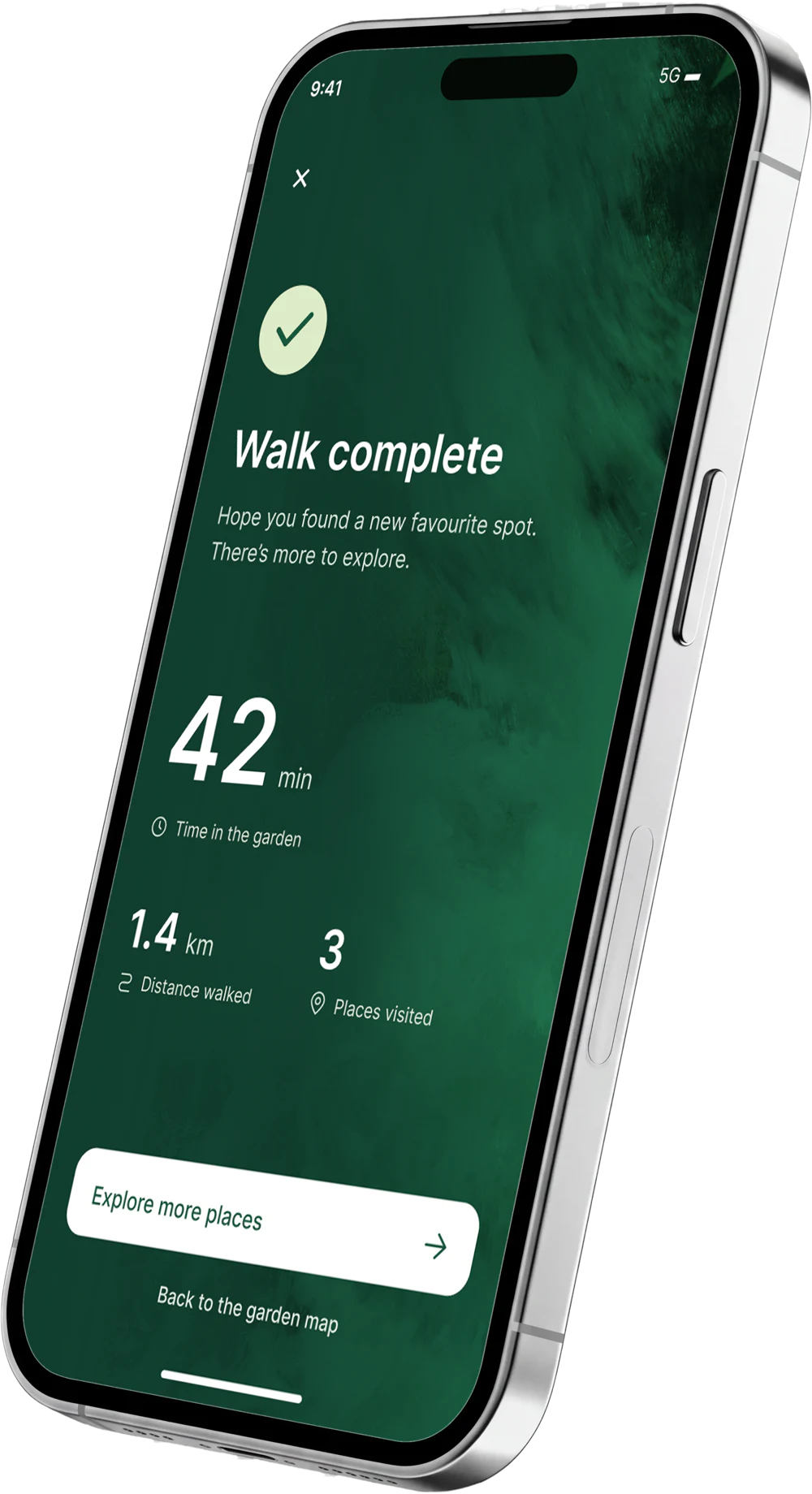
A walk from start to finish
Follow, pause, change your route and finish at your own pace.
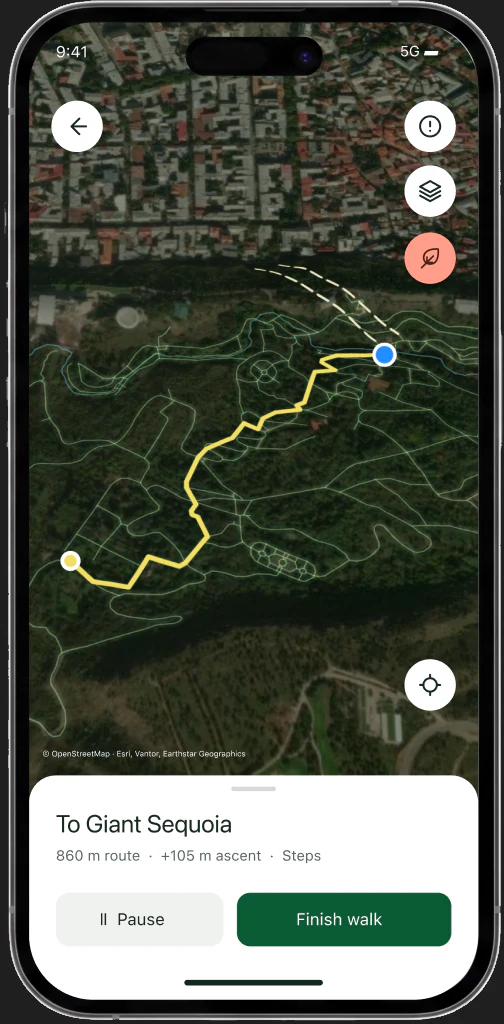 Following the route
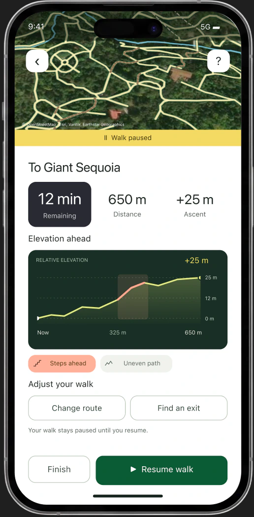 Paused
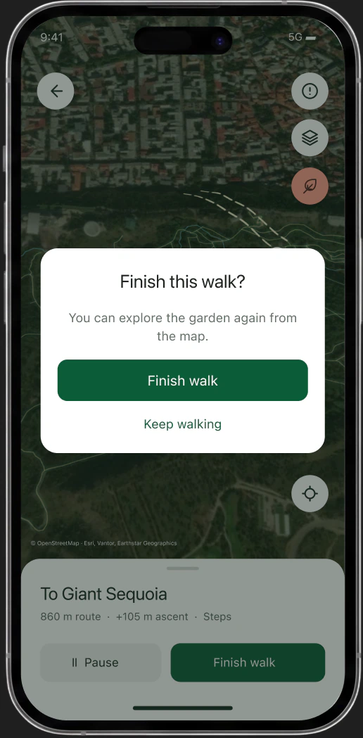 Finish confirmation
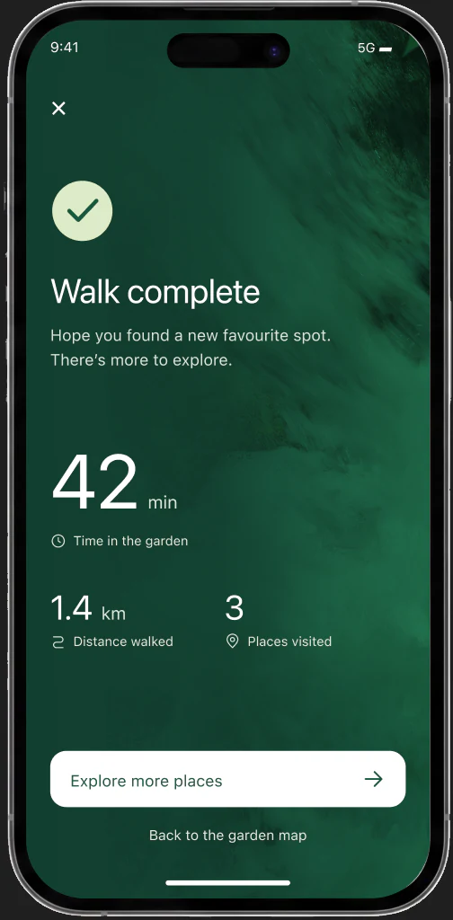 Walk complete
Your walk, your pace
Keep the route while paused. Confirm before finishing, then return to the garden.
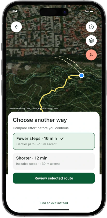
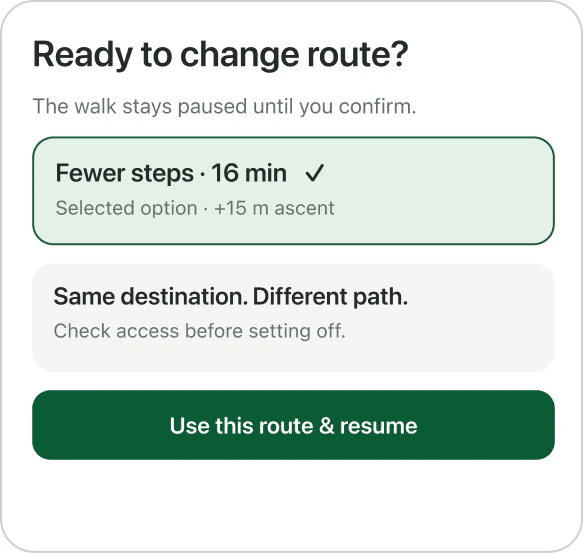
Change of plan
A blocked path or a tougher climb. Review an alternative, or choose an exit.
You decide when to continue.
The current route stays in place until you confirm the change.